New Pieces of History at the MAC Lab

By Patricia Samford, Director, Maryland Archaeological Conservation Laboratory

It somehow seems appropriate that the acquisition by the State of Maryland of many of Baltimore’s most important artifact collections would occur during April — Maryland’s Archaeology Month.  These collections, which were generated through the work of the Baltimore Center for Urban Archaeology, will be curated by the Maryland Archaeological Conservation Laboratory (MAC Lab) at Jefferson Patterson Park and Museum.

18bc38 pearlware scratch blue

A privy filled in the early 19th century at the Clagett’s Brewery site (18BC38) yielded 432 ceramic and glass vessels, including this unusual scratch blue pearlware chamberpot bearing the initials of England’s King George.

The formation of the Baltimore Center for Urban Archaeology in April of 1983 was arguably the single most influential action affecting archaeology in the city.  Baltimore mayor William Donald Schaefer, impressed by the Archaeology in Annapolis project, decided that a similar program was needed to promote heritage tourism in Baltimore. Mayor Schaefer envisioned excavations as a way, through the media and public visitation, of promoting Fallswalk, a new historic walking trail along Jones Falls.  In establishing the Center, Schaefer instituted the first public archaeology program ever funded by a major U. S. city.

Over the next fifteen years, the Baltimore Center for Urban Archaeology conducted historical research on 53 city properties, resulting in 21 excavations. Some of the most important projects included the Clagett Brewery (18BC38)—one of Baltimore’s earliest breweries—along Jones Falls, and Cheapside Wharf (18BC55), where the Inner Harbor is located today. The center’s work generated around 500 boxes of artifacts—collections that have revealed important evidence about the city’s past and its important role as a port city.

conservancy tour

Members of an Archaeological Conservancy tour admire artifacts from the privy at Clagett’s Brewery

Elizabeth A. Comer directed the BCUA from its inception in 1983 until 1988, when she left to work in tourism in the Schaefer administration. Upon her departure the direction of the BCUA was shared by Kristen Stevens Peters and Louise Akerson. Louise, who had been the BCUA’s Lab Director since 1983, assumed overall direction of the BCUA when Kristin left in 1990, and continued in that role until her retirement in 1996. Esther Doyle Read was the final director of the BCUA until it was dissolved, along with the City Life Museums, in 1997. The collections generated through the center’s work were acquired by the Maryland Historical Society. For the next twenty years, the collections and the records associated with the excavations were unavailable to researchers and students. Negotiations between the State of Maryland, the City of Baltimore and the Maryland Historical Society resulted in the collections being turned over to the state in April of 2018.

The MAC Lab has already begun to make the collections available to the public.  A sample of artifacts from the Clagett Brewery Site was on display during Jefferson Patterson Park and Museum’s Discovering Archaeology Day event on April 21st and they were also popular with the Archaeological Conservancy tour of the lab.  Over the next several months, artifacts from the collections will begin to be added to the Diagnostic Artifacts in Maryland website and also to Maryland Unearthed, a website that allows the public and researchers to learn more about the collections at the lab.   For more information about this collection or the work of the Maryland Archaeological Conservation Laboratory, please contact patricia.samford@maryland.gov.

Author’s note: This is a slighly updated version of the original article with a few factual errors corrected.

Angling for Archeology

By Troy Nowak, Assistant State Underwater Archeologist, Maryland Historical Trust

“Catch anything?” is positively the most common question we are asked on the water.

“Perhaps?” is usually the correct answer, but not an answer anyone would expect or understand without explanation. There is never time to explain when piloting a skiff with a cable attached to a towfish astern, and crabpots, pilings, or other obstructions dead ahead. The answer is usually a simple “No,” hopefully not accompanied by a scramble to avoid collision.

Contrary to popular belief, we are never fishing and rarely searching for any particular archeological site or shipwreck. As part of the Maryland Historical Trust, Maryland’s State Historic Preservation Office, most of our time on the water is related to routine site inspections of areas where construction is planned, or surveys of areas where development is expected or erosion is accelerating.

John Fiveash and Brent ChippendaleMay 2017 Field Session (1)

John Fiveash and Brent Chippendale, volunteering with the Maryland Maritime Archeology Program as part of the 2017 Annual Field Session in Maryland Archeology.

Each year roughly 700 projects receiving state or federal licenses, permits, or funding find their way to our desks  for review in compliance with state and federal historic preservation laws. All involve activities with potential to impact submerged archeological historic properties and reviews of these projects can take from ten minutes to years of coordination with government agencies and project sponsors. Very few, about ten per year, require site inspections; even less result in recommendations to government agencies for archeological studies prior to construction or other ground disturbance. This process is the frontline against loss of submerged archeological sites and/or the information they can provide to development.

Most site inspections and surveys involve reconnaissance of a discrete area using a side scan sonar, a marine magnetometer, and an echo sounder. Side scan sonar allows us to record detailed images of submerged lands and objects regardless of water clarity and the marine magnetometer helps us find submerged and buried shipwrecks, wharves, or other structures or objects which cause localized distortions in the earth’s magnetic field. The echo sounder is largely used to make sure we don’t run the instruments or the skiff aground, but we can also use the data it collects to produce bathymetric maps which can allow comparisons between current bottom topography and historic charts and maps.

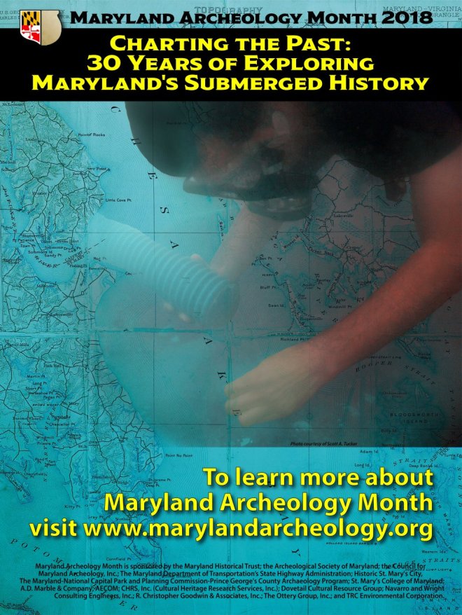
MAM Poster 2018web

This April, Maryland Archeology Month celebrated the 30th anniversary of the Maryland Maritime Archeology Program.

We rarely know if we “caught” anything significant without further work – typically including data processing and review, library and archival research, more survey, and occasionally diving.

Discovery of new sites not only happens during formal site inspections and surveys, but also, and quite often, during the trip home. We typically stow the magnetometer before we depart the area we are formally investigating. It is towed nearly 70 feet astern during operation creating a complication and potential hazard while cruising among other vessels. We often leave the sonar in the water, as it is usually either pole mounted or towed very close alongside, and adjust its range to cover a large area. Now painting in broad strokes, the sonar produces coarse-grained images unsuitable for a typical archeological survey, but good enough to detect large objects protruding from or sitting on the bottom.

Chester_River_Shipwreck

Wooden shipwreck recorded during the  final site visit of 2017.

The return trip usually is planned in advance to pass or quickly inspect areas where the remains of old boats and ships may be hiding, such as inlets where they were often discarded, and shoals where they often ran aground. This is usually the most relaxing and exciting part of the day. The work is done and we can use our knowledge, skill, and a bit of luck to “catch a big one.”

We are often fortunate enough to share the excitement of discovery with volunteers who assist at the helm or scrutinize incoming data for any indication of potential targets. When we get a “bite” we normally turn around and readjust the sonar to capture clear images such as the wooden shipwreck recorded by volunteer Bill Utley and me after the Maryland Maritime Archeology Program’s final site visit of 2017 (see shipwreck photo above). We look forward to returning to the site to learn more about its identity and significance and to more site visits, surveys, and discoveries like this one in 2018.

This post was adapted from Charting the Past:  30 Years of Exploring Maryland’s Submerged History, a booklet written in celebration of Maryland Archeology Month – April 2018.

The Maryland Maritime Archeology Program was established in 1988 in response to the Abandoned Shipwreck Act of 1987, which encourages states to study, protect, preserve, and manage shipwrecks embedded in or on state-controlled submerged lands, and in recognition of the importance of Maryland’s varied submerged cultural resources. The program inventories and manages these resources in collaboration with non-profit organizations and government agencies and shares information with the public through its education and outreach activities.